We have arrived back in the U S of A after 155 days away. Truth be told, it feels good to be back in familiar surroundings, even if those familiar surroundings are the exotic and unique State of Hawaii located 2,045 miles from the continental United States.
Our original itinerary called for our first port in Hawaii to be Hilo on the “Big Island,” Hawaii, but the Kilauea volcano had other ideas and has been erupting since May 3rd. Hilo is far enough away to eliminate any danger, but the concern about the toxicity of the air in Hawaii leads Oceania to the decision to go straight to Honolulu. Originally we were only to spend from 8:00am to 11:00pm on the 7thhere, but now we arrive a day earlier.
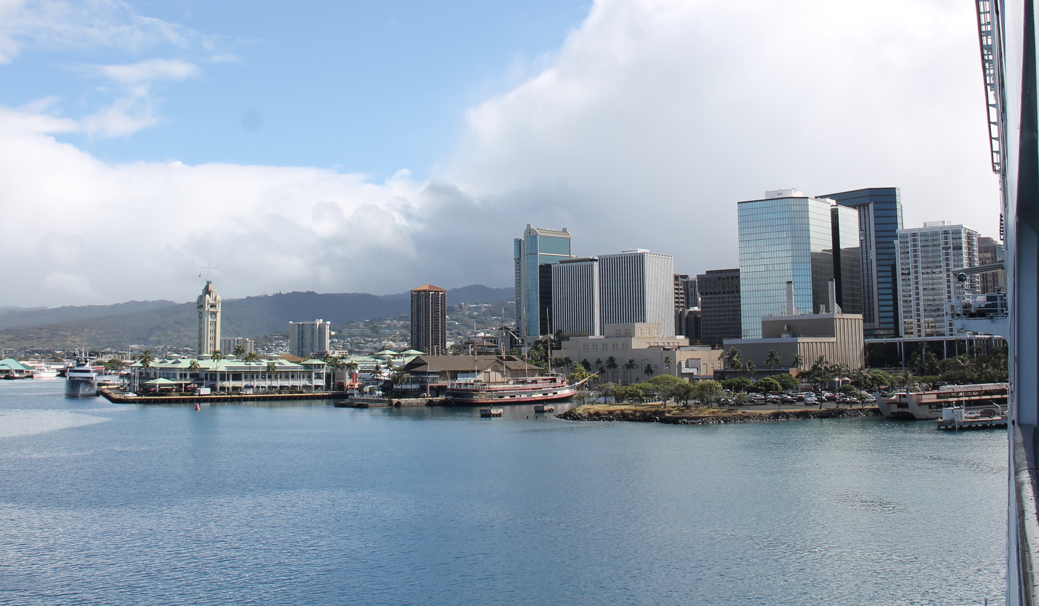
We dock around 12:30pm, an hour later than expected, and apparently all the customs formalities have been taken care of, because, contrary to what we expected, we are advised that the ID we need to carry in 1) our Ship Card and 2) a “government-issued photo ID” like a driver’s license. But Hawaii is very strict about the photo identification: without it, you can’t go off the ship or, if on shore, get back on the pier. This is a port security thing, not so much an immigration requirement.
If we were still on our original itinerary, our excursion was to be Volcanoes National Park Odyssey, so even if we were to actually go to Hilo, that sure would have been canceled. So instead, our excursion is Panoramic Honolulu, and begins in Insignia Lounge at around 1:30pm. Out through the terminal we go and on to our bus. We are greeted by our guide Ed, a jovial guy of Asian ancestry, like much of the population of Hawaii.

We are to drive through the city first. We start by driving by what our guide notes in the world’s largest open-airshopping center, Ala Moana Center that opened in 1959. Then we get to the Waikiki neighborhood, Wai meaning ‘fresh water’ and Kiki meaning ‘to spout or bubble.’ This whole area of Honolulu was once mosquito-infested swamp and the Ali Wai canal was created to help move the fresh water, cascading down from the mountains, to drain the swamp.
We travel past famous Waikiki Beach, home of the legendary Duke Kahanamoku, the Olympic athlete that popularized surfing in the early 20thcentury. The neighborhood is only about three blocks wide. Ed points out that high-rise buildings in Honolulu are fairly small by international standards as there are height restrictions in place. Diamond Head is 760 feet high, so building height is restricted to 250 feet in order that the view of Diamond Head is not restricted.
Waikiki Beach is mostly filled with tourists, the reason being, according to Ed, that the cost of parking is so high. Most of the sand is actually imported, and came from California and Australia as ship ballast. The area has many hotels and high end stores and is beautifully maintained, with many park-like sections with lots of flowers and blooming shrubs. The beach is gorgeous and many people are surfing or windsurfing or para-sailing. It is really very very nice, touristy but not hokey at all. It would be a pleasant place to stay for a couple of days and watch the surfers and relax on the gorgeous beach.
Guide Ed mentions that hurricanes are not much of a threat on Oahu because of the direction of the prevailing wind trough drawing these storms, having originated off of South America, away from the island. Only three hurricanes have hit the island in the past 100 years. Kauai, however, does get hit more often. Tsunamis, on the other hand, are a big concern for this section of Oahu.
Our first stop is the Amelia Earhart Lookout monument at Kuilei Cliffs Beach Park underneath iconic Diamond Head at the very southern tip of the island. She was the first person to fly from Hawaii to California and the flight took place on January 11, 1935. From there we can see Black Point, which Ed says is the Beverly Hills of Hawaii. VERY nice area with gorgeous homes and beautiful view. He points out the Doris Duke Mansion, which is now some sort of museum.


Our second stop is a ways away from the shore but is only a 20-25-minute drive up Route 61: Nu’uanu Pali Lookout above the highway tunnel on HI Route 61. This point is 1,168 high and gives you a fantastic view of the windward side of the island. The wind is howling up here, which it apparently often is. The trade winds come in from the northeast, hitting these cliffs and dumping 150-250 inches of rain a year. The updrafts create clouds that are almost omnipresent here.


Segue to brief moment of Hawaiian history: This is the famous spot where King Kamehameha conquered Oahu by trapping the local soldiers on top and driving them off the cliff! Supposedly for many years bones were discovered at the foot of the cliff. Kamehameha is considered the founder and first ruler of the Kingdom of Hawaii. He originally came from the Big Island of Hawaii and decided to conquer the rest of the islands and have one entity called Hawaii. In 1795 he set out from the Big Island with 960 war canoes and 10,000 men. The islands are not that close together so this was actually quite a feat in itself. He conquered Maui and Molokai (they are fairly close together) and then on to Oahu where he trapped the army on top of the Pali and basically pushed them off. The King of Kauai, hearing about this from his own people in fast canoes, quickly surrendered his island to Kamehameha to preserve peace and save lives. And so it remained until the US “annexed” it as a territory a hundred years later.
We come down on the leeward side, which, because of the mountain range on the eastern side of the island, receive only 15-25 inches of rain a year.

We are back in Honolulu proper. Asked about housing costs, our guide Ed tells us that a house lot years ago that might have been 10,000 square feet will now be 2,000 square feet. He says that many people have moved to the Big Island because land is cheaper … and then he laughs, saying: “And now you know why,” referring to the destruction being wrought by the Kilauea volcano.
We are traveling past many famous buildings in the city when our guide notes that 97% of the plants and animals in Hawaii were brought here, either by ocean currents, wind, birds (seeds stuck in feathers or in droppings) or the Polynesians, who brought in thirty species of plants as well as chickens, pigs and dogs. Dogs were not pets but food.
Honolulu means “Fair Haven” and is a very protected bay. The city was made the capital in the 1840s by King Kamehameha III. The United States “annexed” Hawaii in 1898 specifically because President McKinley was advised that the military needed Pearl Harbor to help fight the Spanish-American War, in which the Philippines was an objective.
We drive by a famous Congregational Church, Kawaiahao Church, built in 1841 out of 14,000 coral blocks with its beautiful clock tower, the clock having been manufactured in England by the same man that built Big Ben in London. Across the street is Honolulu Hale (City Hall).


We stop to admire the Hawaii State Capitol Building that opened in 1969 and our guide points out the various symbolic elements of the architecture, such as these as listed in Wikipedia:
- The building is surrounded by a reflecting pool, symbolizing the Pacific Ocean.
- The two legislative chambers are cone-shaped, symbolizing volcanoesthat formed the Hawaiian Islands.
- The columns around the perimeter of the building have shapes resembling royal palm There are eight columns in four rows at either side of the building, representing the eight main islandsof Hawaii; sets of eight items appear in other places inside and along the outside of the building.
- The Capitol is built with an open-air design, allowing sun, wind, and rain to enter; the central atrium opens to the sky and rainbows can sometimes be seen inside the building when it rains.
- Four kukui nut trees are a numerical reference to the four main counties in the State of Hawaii. Sets of four items appear in many other places in the building.
- When standing in the center of the structure, the chandeliers from both legislative chambers, which represent the sun and moon, can be seen through the glass walls, while the area that is normally reserved for a rotunda in most capitol buildings is left open to the sky. It is said that the sky is Hawaii’s capitol dome.


In the front is a statue of a Hawaiian hero, Father Damien, a Belgian priest who dedicated his life to helping the people with leprosy dumped on the island of Molokai. Father Damien contracted the disease himself and died seventeen years in 1869. Father Damien was canonized in 2009.
We pass by Iolani Palace, the royal palace of the Hawaiian monarchy that has the distinction of being the only royal palace located in the United States. It was the seat of government in Hawaii until the present capitol building was built.

We finish our tour very fittingly at the National Memorial Cemetery of the Pacific, located in Punchbowl Crater. Our guide tells us that all tour buses that travel through Honolulu make a stop here out of respect for all those who died on December 7, 1941 in the attack on Pearl Harbor. Over 53,000 former service members are buried here, as well as one civilian, the celebrated war correspondent Ernie Pyle.


We return to Insigniaaround 4:30pm. It has been a very good start to our visit to Hawaii. It is early enough to do other things such as eat dinner at a local restaurant, but we decide to stay on the ship. We have a pleasant dinner in the Grand Dining Room and retire for the day.
When we get back to our room, we see an enormous barge tying up to Insignia right below our room. The ship is “bunkering,” i.e., taking on fuel, and this barge will be here most of the night. We also get a beautiful view of Honolulu at night.


Oahu is gorgeous. Tomorrow we will see even more when we tour the North Shore!


Pat Kohl
June 20, 2018Hmmm… they were actually able to drain the swamp! 😉